台风灾害防御
Search documents
国家海洋预报台继续发布海浪、风暴潮双红色警报
Yang Shi Wang· 2025-10-05 02:05
Core Points - Typhoon "Maidum" has intensified to a strong typhoon level and is expected to make landfall in Guangdong and Hainan, with warnings issued for storm surges and high waves [1][2] Group 1: Typhoon Impact - The typhoon is expected to bring storm surges of 40 to 130 cm along the coast from Shenzhen to Yangjiang, and up to 380 cm in parts of Guangdong [2] - The storm surge warning levels include red for Maoming and Wenchang, orange for Zhanjiang and Haikou, yellow for Yangjiang, and blue for Guangzhou [2] Group 2: Emergency Measures - Coastal governments and relevant departments are advised to prepare for emergency response to storm surges and sea water backflow [3] - Residents in low-lying areas and unsafe housing should be relocated to safe zones, and outdoor activities near the coast should be prohibited [3] Group 3: Wave Warnings - A red wave warning has been issued, predicting wave heights of 6 to 10 meters in the northwestern South China Sea and 4 to 6 meters along the western coast of Guangdong [6] - The warning levels for waves include red for certain coastal areas and orange for others, with safety measures advised for vessels operating in these regions [6]

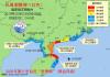
台风“博罗依”影响我国南部海域和华南 四川陕西等地有较强降水
Zhong Guo Xin Wen Wang· 2025-09-28 01:08
Core Points - Typhoon "Bolaoi" is impacting southern coastal areas and South China, with significant wind and rain expected in the coming days [1][2][3] Weather Impact - The center of Typhoon "Bolaoi" was located approximately 255 kilometers southeast of Sanya, Hainan, with maximum wind speeds of 12 levels (35 m/s) and a minimum central pressure of 970 hPa [2] - The typhoon is expected to move northwest at a speed of 25-30 km/h, passing south of Hainan Island and approaching the central and northern coast of Vietnam, where it is forecasted to make landfall as a typhoon [2][3] - From September 28 to 30, heavy rainfall is expected in Hainan Island, southwestern Guangdong, southern and western Guangxi, eastern and southern Yunnan, and southern Guizhou, with localized areas experiencing extreme rainfall [3][7] Rainfall Forecast - Specific rainfall predictions indicate that from September 28, 8 AM to September 29, 8 AM, parts of Hainan Island, southern Guangxi, and southwestern Guangdong may experience heavy to extreme rainfall, with localized areas in southeastern Hainan receiving 250-280 mm [3][8] - The forecast also includes warnings for strong convective weather, such as thunderstorms and strong winds, in affected regions [3][8] Wind Forecast - Wind speeds of 6-8 levels with gusts of 9-10 levels are expected in the South China Sea, Beibu Gulf, and coastal areas of Guangdong and Guangxi [2][8] - Areas near the typhoon's center may experience wind speeds reaching 11-13 levels, with gusts of 14-15 levels [2]

大暴雨、特大暴雨,要来了
中国基金报· 2025-09-27 23:07
Group 1 - The Central Meteorological Administration issued a yellow rainstorm warning, predicting heavy rain in various regions including eastern and southern Sichuan, southern Shaanxi, western Henan, and parts of Hainan Island, with localized extreme rainfall expected to reach 250-280 mm [2][4] - The warning indicates that short-term heavy rainfall may occur, with maximum hourly rainfall of 20-50 mm, and localized areas possibly exceeding 60 mm, along with thunderstorms and strong winds [2][4] Group 2 - A yellow typhoon warning was issued for Typhoon "Bolaoi," which was located approximately 255 km southeast of Sanya, Hainan, with maximum wind speeds of 12 levels (35 m/s) and a minimum central pressure of 970 hPa [6][12] - The typhoon is expected to move northwest at a speed of 25-30 km/h, strengthening as it approaches the northern coast of Vietnam, where it is forecasted to make landfall as a typhoon [6][12] - Wind forecasts indicate that from 08:00 on September 28 to 08:00 on September 29, areas including the South China Sea and Hainan Island will experience winds of 6-8 levels, with gusts reaching 9-10 levels, and localized areas may see winds of 11-13 levels [7][12]

台风“博罗依”或将以强台风级近海擦过海南岛南部
Zhong Guo Xin Wen Wang· 2025-09-26 05:22
Core Viewpoint - Typhoon "Bolaven" is expected to approach the southern coast of Hainan Island at strong typhoon level, potentially causing severe impacts on the region [1][5]. Weather Forecast - On September 26, Typhoon "Bolaven" was located approximately 1,230 kilometers southeast of Yongxing Island, with maximum wind force of level 11 (30 m/s) and a radius of level 7 wind circle of 300-320 kilometers [1]. - The typhoon is projected to move northwest at a speed of 30-35 km/h, entering the South China Sea and approaching the Xisha Islands, with the potential to reach strong typhoon level [1][2]. Marine Conditions - On September 27, the wind force in the Beibu Gulf and Qiongzhou Strait is expected to be 5-6 levels, with gusts reaching 7-8 levels; the eastern and southern seas of Hainan Island will see wind forces of 6-7 levels, increasing to 8-9 levels at night [2]. - From September 28 to 29, wind forces in the northern Beibu Gulf and Qiongzhou Strait will reach 7-8 levels, while the Xisha Islands will experience wind forces of 12-13 levels, with gusts of 14-15 levels [2]. Land Impact - From September 26 to 27, Hainan Island is forecasted to have cloudy weather with showers or thunderstorms, with some areas experiencing heavy rain to torrential rain [3]. - From September 28 to 29, most areas of the island are expected to see heavy rain to extremely heavy rain, with localized areas experiencing exceptionally heavy rain [3]. Precautionary Measures - The Hainan meteorological department advises maritime platforms and vessels operating in the eastern and central South China Sea to prepare for strong winds [5]. - The islands in the Zhongsha and Xisha groups are urged to implement typhoon prevention measures as "Bolaven" is expected to directly impact these areas [5].
滚动更新|“桦加沙”12级风圈开始影响珠海、江门台山南部沿海
2 1 Shi Ji Jing Ji Bao Dao· 2025-09-24 03:44
Core Points - Typhoon "Hagupit" is currently classified as a super typhoon with maximum wind speeds of 16 levels (55 m/s) and is expected to make landfall in the coastal areas between Taishan and Zhanjiang on the evening of September 24 [1][3][4] - The typhoon's impact is anticipated to bring heavy rainfall and strong winds across various regions in Guangdong, with specific warnings issued for areas like the Pearl River Delta and western Guangdong [3][7][23] Group 1 - The maximum wind speed recorded near the typhoon's center is 16 levels (55 m/s), with a minimum central pressure of 930 hPa [1][5][14] - The typhoon's wind radius includes a 12-level wind circle affecting areas such as Zhuhai and Jiangmen, with significant wind speeds already reported [1][10] - As of September 24, over 1.89 million people have been evacuated in Guangdong in preparation for the typhoon's impact [7][26] Group 2 - Shenzhen has entered a state of emergency, with significant rainfall recorded, including an average of 49.3 mm and a maximum of 137.9 mm in certain areas [5][6] - The Shenzhen airport has canceled a large number of flights due to the typhoon, with 586 outbound and 473 inbound flights canceled as of September 24 [9][11] - The city of Zhanjiang has implemented a "five-stop" policy, halting classes, work, production, transportation, and business operations to ensure safety [8][20] Group 3 - The Hong Kong Observatory has issued a "ten" signal, indicating severe weather conditions with sustained winds of 63 to 117 km/h and gusts potentially exceeding 180 km/h [26][30] - The Macau government has also issued a "ten" signal, with expectations of severe flooding in low-lying areas due to storm surges [30][32] - The National Emergency Management Office has dispatched emergency supplies to Guangdong to assist in disaster response efforts [28]

台风+暴雨双预警 “桦加沙”今天将登陆 广东局地或遭特大暴雨
Yang Shi Xin Wen· 2025-09-23 23:59
Core Points - The Central Meteorological Observatory issued an orange alert for Typhoon Haikui, which is expected to make landfall in Guangdong province between Taishan and Zhanjiang on the evening of September 24, with maximum wind speeds of 16 levels (55 m/s) and a minimum central pressure of 930 hPa [1] - Heavy rainfall is forecasted for several regions, particularly in southern Guangdong, southeastern Fujian, and western Hainan, with localized extreme rainfall expected to reach 250-270 mm [2][5] Group 1: Typhoon Information - Typhoon Haikui is currently located approximately 255 kilometers southeast of Yangjiang, Guangdong, and is moving northwest at about 20 km/h [1] - The typhoon is expected to weaken after landfall, but strong winds of 10-13 levels (28-38 m/s) are anticipated in coastal areas [1] Group 2: Rainfall Forecast - Significant rainfall is expected from September 24 to 25, with areas in Guangdong, Guangxi, Fujian, Hainan, and other regions experiencing heavy to torrential rain [2][5] - Specific areas in southern Guangdong and southeastern Fujian may experience extreme rainfall, with localized short-term heavy downpours exceeding 70 mm [5] Group 3: Defense Guidelines - Government and relevant departments are advised to prepare for emergency responses to the typhoon and heavy rainfall [3][6] - Precautions include halting outdoor activities, securing vulnerable structures, and ensuring the safety of individuals in high-risk areas [4][7]
“桦加沙”强势逼近!华南江南等地台风雨强劲 需警惕风雨致灾
Yang Shi Wang· 2025-09-23 00:32
Core Viewpoint - The super typhoon "Haikashan" is approaching China, expected to bring extreme wind and rain to southern regions, particularly affecting Guangdong and surrounding areas [2][6]. Group 1: Typhoon Characteristics - "Haikashan" intensified rapidly, becoming a super typhoon on September 21, with wind speeds exceeding 17 levels [2]. - The typhoon is currently located approximately 750 kilometers south-southeast of Yangjiang, Guangdong, and is moving northwest at about 20 kilometers per hour [2]. Group 2: Affected Regions and Weather Forecast - From September 23 to 25, regions in South China and southern Jiangnan are expected to experience heavy rainfall, with localized areas in Taiwan and coastal Guangdong potentially receiving over 400 millimeters of rain [2]. - The Central Meteorological Observatory predicts heavy to torrential rain in several areas, including parts of Liaoning, Shandong, Jiangsu, and Taiwan [3][4]. Group 3: Preparedness and Risks - Coastal areas in Guangdong, Guangxi, Hainan, Fujian, and Hong Kong need to prepare for the typhoon's impact, as the strong winds pose a high disaster risk [6]. - The occurrence of astronomical tides during this period may lead to seawater backflow in cities like Guangzhou and Zhuhai, increasing the risk of storm surges [7].

佛山:全市分批停课、停工、停产、停运、停业
Nan Fang Du Shi Bao· 2025-09-23 00:05
Core Points - The article discusses the severe impact of Super Typhoon "Haikui" expected to make landfall in Guangdong on September 24, prompting the local government to implement emergency measures to protect public safety and minimize disaster losses [1][2]. Group 1: Emergency Measures - From September 23 to 24, all educational institutions including primary, secondary, and higher education will suspend classes, and outdoor training institutions must comply with the closure regulations [1]. - All construction sites, tourist attractions, parks, and ferry services will be closed starting from September 23 at 12 PM until the end of September 24, with specific measures for securing construction equipment [1]. - Public transportation, including ferries and freight services, will cease operations from September 23 at 9 PM until the end of September 24, along with the suspension of outdoor and large-scale public activities [1][2]. Group 2: Special Industry Exemptions - On September 24, only essential services related to disaster response, medical care, and basic living necessities such as water, electricity, and gas supply will continue operations, while non-essential industries may take a holiday [2]. Group 3: Public Advisory - The public is advised to stay informed about the typhoon's forecast and any adjustments to the emergency measures as the situation develops [2].

防御台风“桦加沙” 深圳全市停课、机场停航、铁路停运
Xin Hua Wang· 2025-09-22 16:34
Core Points - Shenzhen has announced school closures and transportation suspensions in response to Typhoon "Haikashan" from September 23 to 24 [1] - The city has upgraded its typhoon warning from blue to yellow, indicating increased severity of the storm [1] - Experts predict significant risks including extreme winds, tidal surges, and heavy rainfall, with expected rainfall around 300 millimeters [1] Group 1 - Shenzhen's schools, kindergartens, and off-campus education institutions will suspend classes in accordance with the typhoon alert [1] - Shenzhen Airport will halt flight operations starting from 20:00 on September 23 [1] - Train services in all directions will gradually cease from 12:00 on September 23, with a complete suspension from 18:00 on September 23 to 24:00 on September 24 [1] Group 2 - The typhoon is expected to bring extreme winds, with potential landfall at a strength of 16, which could significantly increase the duration and area of damage [1] - The storm coincides with a lunar high tide, which may exacerbate flooding risks due to elevated sea levels [1] - Preparations include the closure of all passenger ship routes, bringing fishing vessels and aquaculture personnel ashore, and readiness of 865 emergency shelters [1]
广州、佛山停课,深圳启动四级响应
21世纪经济报道· 2025-09-22 14:28
Group 1 - The article discusses the impact of Typhoon "Haikui" on various regions, including school closures in Guangzhou due to yellow and orange typhoon warnings issued by the local education bureau [1][3] - Shenzhen has initiated a level four response to the typhoon, with 865 emergency shelters prepared for use, and is closely monitoring the typhoon's development [4][5] - The typhoon is expected to bring extreme weather conditions, including strong winds reaching up to level 17, heavy rainfall of approximately 300 millimeters, and the risk of urban flooding due to storm surges and astronomical tides [8][10] Group 2 - The article highlights the need for residents to prepare emergency supplies for at least three days in anticipation of the typhoon's impact [10] - It emphasizes the importance of adhering to government warnings and safety measures to mitigate risks associated with the typhoon [8][9]
