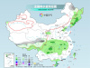
雾
Search documents
1月四川气温为历史同期第9高位,2月是冷是暖?
Xin Lang Cai Jing· 2026-02-08 14:26
Core Insights - In February, Sichuan will continue the warm and dry climate trend observed in January, with a high risk of seasonal winter dryness in certain areas, particularly in the western plateau and Panxi regions, necessitating enhanced preventive measures [1][3] Temperature and Precipitation - The average temperature in Sichuan for February is expected to be between 8.5 and 9.0°C, which is higher than the historical average of 7.5°C [1] - The average precipitation for February is forecasted to be between 10.5 and 12.5 millimeters, lower than the historical average of 13.4 millimeters [1] - Specific regions such as Ganzi and Panxi are expected to see precipitation levels 20% to 50% below historical averages, while the northern basin may experience 10% to 20% above average precipitation [1][3] Drought Conditions - As of January 31, 48 out of 156 national meteorological observation stations in Sichuan reported ongoing meteorological drought conditions, with varying degrees of severity [1][3] - The areas most affected by moderate to severe drought include northern Ganzi, northern Aba, and parts of Liangshan and the western basin [1][3] Fire Risk and Weather Monitoring - The fire risk level in February for the western plateau, Ganzi, and Panxi regions is projected to be at level 3, with potential increases to level 2 during dry and windy periods [3] - The Sichuan Climate Center emphasizes the need for fire risk monitoring and management, especially with increased human activity during the Spring Festival [3] Air Quality and Weather Conditions - The probability of stable weather conditions in the basin is high, which may hinder the dispersion of pollutants and lead to fog and haze [3] - The winter season is characterized by frequent fog, while mountainous and plateau areas may experience rain and snow, necessitating enhanced monitoring to mitigate transportation impacts [3]


夹雪转小雪!河南将迎大范围降水
Xin Lang Cai Jing· 2025-12-27 12:31
Group 1 - The core viewpoint of the article highlights the upcoming weather changes, including a significant temperature drop and the arrival of cold air masses affecting the region [3][4][6] - The first cold air mass is expected to arrive from the night of December 28 to December 30, primarily causing a drop in temperature [3][6] - The second cold air mass will begin affecting the area on December 31, bringing strong winds and continued low temperatures into the new year [4][6] Group 2 - The forecast indicates that the highest temperatures will decrease by 6 to 8 degrees Celsius by December 31, with the lowest temperatures expected to reach around -6 degrees Celsius by January 3 [6] - Visibility issues due to fog and potential road hazards from rain and snow are anticipated, urging the public to take precautions [8] - The weather forecast for the next three days includes mostly sunny to partly cloudy conditions, with specific mentions of fog in the eastern and southwestern regions [8][10][11][12][13]

南方多地今晨能见度不佳局地现特强浓雾 本周中后期寒潮驱散雾和霾
Yang Shi Wang· 2025-12-08 04:03
Group 1 - Southern regions of China experienced heavy fog this morning, with visibility in some areas dropping below 50 meters, such as 32 meters in Youxi and 49 meters at Jiuxianshan [1][3] - Air quality issues were reported, with severe pollution in Fuyang, Anhui, and haze conditions in parts of Anhui, Zhejiang, and Hunan [3] - A cold wave is expected to bring strong winds, temperature drops of 6 to 10 degrees Celsius, and localized drops of around 16 degrees Celsius, starting from Xinjiang and moving eastward across the country [3][5] Group 2 - From December 11 to 13, widespread rain and snow are forecasted across central and eastern China, with regions like the Sichuan Basin and southern Jianghan expected to receive light to moderate rain, and parts of Xinjiang and the northeast experiencing light snow or sleet [5] - The cold air mass will improve atmospheric dispersion conditions in North China and the Huanghuai region after December 12, alleviating haze issues [3][5]

我国中东部降水发展多地气温下滑 青藏高原大范围雨雪持续
Yang Shi Wang· 2025-10-29 00:33
Summary of Key Points Core Viewpoint - The upcoming three days (October 29 to 31) will see frequent rain and snow in parts of the Tibetan Plateau, while precipitation will increase in the central and eastern regions of China, necessitating public attention to travel safety during inclement weather [1][2][7]. Weather Conditions - Significant snowfall was reported in parts of the Tibetan Plateau, with light to moderate snow or sleet observed in regions such as eastern Tibet and northern Sichuan Plateau [2][4]. - The Central Meteorological Observatory forecasts continued widespread rain and snow in the Tibetan Plateau, with central and eastern China experiencing increased precipitation, primarily light to moderate rain [2][6]. Temperature Changes - Southern regions will experience a slight drop in temperatures due to increased rainfall, with maximum temperatures in cities like Guiyang and Changsha expected to decrease significantly [5][8]. - A cold air mass is anticipated to impact central and eastern China later this week, leading to temperature drops of 4 to 6 degrees Celsius, with some areas experiencing drops exceeding 8 degrees Celsius [5][8]. Public Advisory - Meteorological authorities have advised the public to take precautions against cold weather and to be aware of the potential impacts of snow on transportation and agriculture [7].