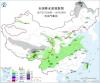
雾和霾
Search documents
直冲20℃ 河南开启回暖模式
Xin Lang Cai Jing· 2026-02-17 08:04
Group 1 - The last snowfall of the Year of the Snake has ended, with light to moderate snow in parts of the west and southwest, and light rain in the central and eastern regions [1] - A significant warming trend is expected from today until the fifth day of the new year, with temperatures in many areas reaching over 20°C, peaking at around 25°C in cities like Zhengzhou, Anyang, and Kaifeng on the 21st [3][4] - The temperature difference between day and night is increasing, exceeding 16°C in most areas from the 19th to the 21st, with some regions exceeding 20°C [5] Group 2 - Strong winds are forecasted on the 20th and 21st, with western or southwestern winds at 3 to 4 levels and gusts around 6 levels, prompting caution for outdoor activities [6] - As temperatures rise, the forest fire risk level is expected to increase over the next six days, advising against carrying fire sources in mountainous areas [8] - Fog and haze are anticipated due to increased humidity after the rain and snow, with light to moderate haze expected in the afternoon and evening [9] Group 3 - A cold air mass is expected to impact the province at the end of the Spring Festival holiday, bringing strong winds and a drop in temperature along with rain and snow [11] - The temperature fluctuations during the Spring Festival holiday have been significant, requiring the public to adjust clothing accordingly to prevent colds [12] - The weather forecast for the next three days indicates mostly sunny to partly cloudy conditions with light to moderate haze, and fog in some areas overnight [13][14][15]


今夜主城区大概率见雪
Xin Lang Cai Jing· 2026-01-19 17:08
Summary of Key Points Core Viewpoint - A strong cold wave is set to impact the city from January 19, bringing significant temperature drops, strong winds, rain, snow, and freezing conditions, with temperatures expected to fall between -1°C to -6°C starting January 21 [1][2]. Weather Impact - The cold wave will lead to a temperature drop of 10°C to 12°C from January 19, with average daily temperatures significantly decreasing [1]. - Wind speeds are expected to increase, with most areas experiencing gusts of 6 to 8 levels, and some regions may reach above level 9 [1]. - Rain and snow are forecasted from January 19 to 22, with the main snowfall occurring from January 20 to the morning of January 21 [1]. Snowfall Details - The city center is likely to experience pure snow on the night of January 20, marking the first occurrence in two years [2]. - Snow accumulation is expected to be around 5 millimeters, with some areas seeing 1 to 2 centimeters of snow, and mountainous regions potentially receiving 2 to 5 centimeters [1]. Safety Precautions - Residents are advised to drive cautiously due to slippery roads and to be aware of falling objects due to strong winds [2]. - Precautions should be taken regarding electrical and water supply systems to prevent freezing and ensure normal living conditions during the cold wave [2]. Air Quality - A distinction was made between fog and haze, with recent conditions classified as haze due to insufficient humidity for fog formation [2]. - The arrival of rain and snow is expected to improve air quality by increasing humidity levels [2].

周末寒潮携大风来袭,江苏多地气温骤降8~9℃
Xin Lang Cai Jing· 2025-12-19 13:19
Core Viewpoint - The article discusses a significant temperature increase in the central and eastern regions of China, with some areas breaking historical records, followed by a forecasted sharp drop in temperatures due to incoming cold air [1]. Weather Forecast Summary - On December 19, temperatures in Nanjing reached over 20°C, significantly higher than the usual 10°C for mid-December, marking a record high [1]. - A cold air mass is expected to move from north to south, leading to a "cliff-like" drop in temperatures across most of the central and eastern regions, returning to seasonal averages [1]. - A blue cold wave warning has been issued for Jiangsu Province, predicting a temperature drop of 8-9°C in certain areas and 6-7°C in others from December 20 to 22 [1]. - The lowest temperatures are anticipated on the morning of December 22, with northern areas potentially reaching around -2°C and localized frost expected [1]. Precipitation and Drought Conditions - Jiangsu has been experiencing below-average precipitation, with southern regions facing moderate to severe drought conditions [1]. - Light rain is expected in some areas south of the Huai River on December 20, but the rainfall is likely to be insufficient to alleviate drought conditions, serving only to slightly moisten the environment [1]. - Additionally, fog and haze are forecasted for December 20, necessitating public health precautions, with improvements expected after December 21 [1].
雾和霾反复来扰!下周中后期较强冷空气登场 南方仍将阴雨频繁
Yang Shi Wang· 2025-11-01 12:06
Summary of Key Points Core Viewpoint - The article discusses the recent weather conditions in China, particularly focusing on the occurrence of dense fog in several regions, the expected changes in weather patterns, and the implications for air quality and temperature fluctuations. Group 1: Weather Conditions - Multiple regions including Beijing, Tianjin, Hebei, Henan, Shandong, Jiangsu, Anhui, and Hubei experienced dense fog, with visibility dropping below 50 meters in areas like Tongzhou, Dezhou, Shangqiu, Bengbu, and Huainan [1][3] - A red alert for fog was issued in Julu County, Hebei, indicating severe visibility issues [3] Group 2: Future Weather Predictions - Following the fog, the weather is expected to improve due to sunlight and weak cold air, with no significant smog forecasted for the next few days [3] - However, from November 4 to 7, the air quality in North China and the Huanghuai region is predicted to deteriorate again, leading to the return of fog and haze [5] Group 3: Temperature Trends - The temperature in central and southern North China is currently around or above 20°C, marking a recent high [8] - A significant drop in temperature is anticipated next week due to a strong cold air mass, with expected decreases of 4 to 8°C in many areas, and localized drops exceeding 10°C [8] Group 4: Rainfall and Flood Risks - From November 2 to 4, heavy rainfall is expected in the eastern Southwest, central and southern Jiangnan, eastern Guangxi, western Guangdong, and Hainan, with cumulative precipitation reaching 30 to 80 millimeters, and localized areas in Yunnan and Hainan potentially exceeding 200 millimeters [9][13] - The rainfall may lead to significant flooding risks in certain regions, particularly in Yunnan and southern Sichuan, where the rainfall could surpass the total for the entire month of October [13] Group 5: Tropical Weather Developments - The Japan Meteorological Agency has classified a tropical disturbance east of the Philippines as a tropical depression, which is expected to develop into Typhoon "Haigui" by November 5, with potential impacts on the South China Sea [14]

北方“专属”冷空气让气温再探底 下周气温20℃线将重回黄河流域
Yang Shi Wang· 2025-10-25 12:47
Group 1 - A new cold air mass has arrived, primarily affecting northern regions of China, while southern areas remain warm with temperatures reaching around 30°C in places like Guangdong and Hainan [1][3] - Northern cities such as Changchun and Shenyang are expected to experience their lowest temperatures of the year, with highs of 4°C and 8°C respectively [3] - The overall trend for the coming days indicates a gradual warming in the central and eastern regions of China, with temperatures expected to return to normal or slightly above normal levels after October 28 [3] Group 2 - Fog and haze are anticipated in northern regions during the intervals between cold air impacts, particularly affecting areas like southern Hebei and most of Shandong [5] - Historically, from September to February, northern China experiences a significant number of foggy days, with cities like Shijiazhuang and Tianjin seeing over 80% of their annual fog days during autumn and winter [5] - Snowfall is expected in northeastern Inner Mongolia and northern Heilongjiang due to the new cold air, with localized heavy snow possible [6] Group 3 - The southwestern region of China is forecasted to have frequent rainfall in the last days of October, particularly in areas like Sichuan and Yunnan, with precipitation expected over 4 to 7 days [6]

中央气象台:今起冷空气影响内蒙古东北地区等地
Zhong Guo Xin Wen Wang· 2025-10-25 02:23
Summary of Key Points Core Viewpoint - The Central Meteorological Administration forecasts significant cold air impacts across various regions in China, including Inner Mongolia, Northeast China, North China, and the Huanghuai area, leading to strong winds and temperature drops [1][4]. Group 1: Weather Forecast - From October 25 to 26, areas such as eastern and southern Qinghai, northern and eastern Tibet, and central and southern Gansu are expected to experience light to moderate snow or sleet, with some regions facing heavy snow and local blizzards [1]. - Starting today until October 27, cold air will affect central and eastern Inner Mongolia, Northeast China, North China, and Huanghuai, with wind speeds of 4 to 6 levels, gusts reaching 7 to 8 levels, and localized gusts up to 9 levels [4]. - Temperature drops of 4 to 6 degrees Celsius are anticipated in some areas, with local drops exceeding 8 degrees Celsius [4]. Group 2: Visibility and Air Quality - Prior to the cold air impact, areas in North China and Huanghuai will experience fog and haze, with significant visibility reductions in regions such as southern Hebei, southern Beijing, and central Shaanxi [4]. - This morning and into the afternoon, heavy fog is expected in southern Hebei, southern Beijing, and central Guizhou, with visibility potentially dropping below 200 meters in some areas [4].