Zhong Guo Zi Ran Zi Yuan Bao
Search documents
部省县三级联动开展星地同步试验
Zhong Guo Zi Ran Zi Yuan Bao· 2025-10-21 04:36
本报讯 近日,黑龙江省自然资源权益调查监测院(黑龙江省自然资源卫星应用技术中心,以下简称"黑龙江省卫星中心")与黑龙江省 塔河县人民政府,联合自然资源部国土卫星遥感应用中心、国家卫星海洋应用中心,在大兴安岭塔河县二十二站林场开展星地同步验证试 验。 此次试验聚焦5米光学卫星、句芒号卫星及新一代海洋水色监测卫星的自然资源碳汇遥感监测能力,进一步深化国产遥感卫星在自然资 源调查、碳汇计量领域的实战应用,为提升大兴安岭典型地物碳汇计量精度提供关键技术支撑。试验利用高光谱卫星光谱信息与地面采集 数据比对,精准反演植被叶绿素等碳汇关键指标。为确保数据精度,技术人员精准对接5米光学卫星、新一代海洋水色监测卫星过境时间, 在二十二站林场同步开展森林、湿地植被光谱采集与样本采集,所有样本均送至实验室进行碳、氮、叶绿素等碳汇核心指标测定,同步采 集周边森林、湿地、大气指数样本,构建"卫星—地面"数据校准体系。 针对句芒号卫星"激光+多光谱+多角度+超光谱+偏振"的综合遥感优势,试验团队采用"卫星+无人机+地面"立体监测模式,完成合计 1200公顷样地的激光点云拍摄,以及10个卫星激光点落点样地内树木数量、种类、平均胸径及树高等 ...


中非卫星遥感应用合作中心二○二五年会议周开幕
Zhong Guo Zi Ran Zi Yuan Bao· 2025-10-21 04:35
本次会议周持续至10月24日,其间将举办中非卫星遥感应用合作研讨会、工作会议等多场专题活 动,参会的非洲国家、国际组织代表将介绍各自在卫星遥感应用、空间信息管理等方面的总体情况、成 功案例、经验和需求等,进一步推动中非在地球观测与可持续发展领域的深度合作。 据悉,中非卫星遥感应用合作中心自2023年7月成立以来,已与非洲16个国家的政府部门以及非洲 资源测绘发展区域中心签署合作备忘录,建成14个自然资源卫星遥感云服务平台节点,累计向非洲合作 伙伴免费提供了超过7万景高分辨率遥感影像;举办研讨会、高级研修班及线上培训,覆盖非洲各国超 400人次,与高校联合培养十余名非洲博士与硕士研究生。该中心围绕城市发展、土地利用变化、流域 监测等领域,形成了一系列遥感产品、图册及软件成果,未来将与非洲伙伴共同验证并推广更多应用。 (部讯) 本报讯10月20日,中非卫星遥感应用合作中心2025年会议周在浙江德清隆重开幕。来自非洲20个国 家、国际组织、驻华使馆及中方共建单位近140位代表共商中非卫星遥感合作发展大计。 本次会议周以"卫星遥感应用合作,赋能中非新未来"为主题,由自然资源部国际合作司指导,自然 资源部国土卫星遥感应 ...
中非卫星遥感应用合作中心2025年会议周开幕
Zhong Guo Zi Ran Zi Yuan Bao· 2025-10-21 02:53
10月20日,中非卫星遥感应用合作中心2025年会议周在浙江德清隆重开幕。来自非洲20个国家、国际组 织、驻华使馆及中方共建单位近140位代表共商中非卫星遥感合作发展大计。 本次会议周以"卫星遥感应用合作,赋能中非新未来"为主题,由自然资源部国际合作司指导,自然资源 部国土卫星遥感应用中心、国家卫星海洋应用中心联合主办,联合国全球地理信息知识与创新中心、德 清县人民政府支持。 本次会议周持续至10月24日,其间将举办中非卫星遥感应用合作研讨会、工作会议等多场专题活动,参 会的非洲国家、国际组织代表将介绍各自在卫星遥感应用、空间信息管理等方面的总体情况、成功案 例、经验和需求等,进一步推动中非在地球观测与可持续发展领域的深度合作。 据悉,中非卫星遥感应用合作中心自2023年7月成立以来,已与非洲16个国家的政府部门以及非洲资源 测绘发展区域中心签署合作备忘录,建成14个自然资源卫星遥感云服务平台节点,累计向非洲合作伙伴 免费提供了超过7万景高分辨率遥感影像;举办研讨会、高级研修班及线上培训,覆盖非洲各国超400人 次,与高校联合培养十余名非洲博士与硕士研究生。该中心围绕城市发展、土地利用变化、流域监测等 领域, ...
自然资源部“十四五”期间发布重点领域标准857项
Zhong Guo Zi Ran Zi Yuan Bao· 2025-10-21 01:40
Core Insights - The 56th World Standards Day focused on the theme of empowering high-quality development of natural resources, with the Ministry of Natural Resources summarizing the achievements of standardization work during the 14th Five-Year Plan and outlining directions for the 15th Five-Year Plan [1] Group 1: Achievements during the 14th Five-Year Plan - A high-quality standard system was established, including a top-level design document that encompasses 13 sub-systems and 52 professional categories, with over 3,700 standards developed [2] - A total of 857 national and industry standards were published in key areas over five years, supporting various sectors such as land space planning, ecological protection, and geological disaster prevention [2] - International influence was enhanced with the development and publication of 23 international standards, a 50% increase compared to the 13th Five-Year Plan, and the promotion of 41 international standards for domestic conversion [2] - A mechanism for innovation was introduced, leading to the free public access of 2,067 existing standards and extensive training on standardization [2] Group 2: Focus Areas for the 15th Five-Year Plan - The optimization and upgrading of the standard system will be prioritized, with an emphasis on integrating standards for nine resource categories and emerging fields such as marine carbon sinks and smart cities [3] - Key areas such as green development and resource security will see accelerated standard development, particularly in emerging industries like deep-sea exploration and smart vehicles [3] - High-level international engagement will be pursued, with initiatives to support Chinese experts in international organizations and lead the formulation of international standards [3] - The effectiveness of standard implementation will be ensured through continuous evaluation and lifecycle management, promoting the practical application of standards [3] Group 3: Expert Contributions - Experts from various sectors provided insights on standards related to land space planning, digital governance of natural resources, and ecological restoration of mining areas, among others, through online platforms [4]
自然资源与地理学交叉前沿学术讲座与应用发展研讨会提出 以科技多维融合创新支撑自然资源改革发展
Zhong Guo Zi Ran Zi Yuan Bao· 2025-10-20 02:33
10月10日,自然资源与地理学交叉前沿学术讲座与应用发展研讨会在北京举办。会议聚焦自然资源相关 学科发展前沿以及土地科学、耕地保护、国土空间等领域热点议题,汇聚相关学会、高校、科研院所与 自然资源行业机构的专家学者,共同探讨科技多维度融合式创新赋能自然资源改革发展的新路径, 会上,特邀专家围绕自然资源管理与土地系统科学、新时期耕地保护制度逻辑及应用、国土空间规划体 检评估、全域土地综合整治、自然资源资产价值实现路径等内容做了专题报告。与会专家提出,依托土 地利用利用重点实验室平台共建,面向国家需求打开科教融合新局面进一步探索学科发展、人才培养、 成果应用的新机制。 据悉,本次研讨会由北京师范大学地理科学学部与中国国土勘测规划院联合主办,旨在面向自然资源改 革需求,为推动科研成果转化、服务国家战略搭建交流探索平台。 ...
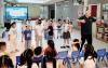
南海预报减灾中心海洋科普润童心
Zhong Guo Zi Ran Zi Yuan Bao· 2025-10-20 02:30
Core Viewpoint - The Natural Resources Department's South China Sea Disaster Reduction Center conducted an engaging marine disaster science lecture for preschool children in Guangzhou, emphasizing the importance of understanding marine hazards through interactive and relatable storytelling methods [1]. Group 1: Educational Approach - The lecture utilized personification and storytelling to explain various marine disasters, making complex concepts accessible to young children [1]. - Marine hazards were creatively described, such as storm surges being likened to "rude visitors" and rip currents as "a seemingly calm yet dangerous water slide" [1]. Group 2: Interactive Learning - Two interactive games were designed to enhance understanding: "The Ocean is Dancing," where children mimicked wave movements, and "Storm Surge is Coming," where they practiced emergency evacuation skills [1][2]. - These games aimed to provide practical skills for responding to storm surges, reinforcing the educational content through active participation [1].
到“会呼吸的海滩”赶海
Zhong Guo Zi Ran Zi Yuan Bao· 2025-10-20 02:30
Core Viewpoint - The article highlights the successful ecological restoration efforts in Qinhuangdao, particularly in the Beidaihe area, showcasing the transformation of the coastal environment and its positive impact on tourism and local economy [4][10][15]. Group 1: Ecological Restoration Efforts - Beidaihe has a coastline of 23.04 kilometers with a natural retention rate of 90.8%, but it faced ecological crises due to rising sea levels, pollution, and erosion [4][5]. - Since 2016, the "Blue Bay" initiative has accelerated marine ecological protection and restoration, leading to a comprehensive ecological defense campaign [5][10]. - The restoration project from Jinwu to Qianshui Bay has repaired nearly 3.5 kilometers of coastline and restored over 100 hectares of coastal wetlands [8][10]. Group 2: Pollution Control Measures - Over 80% of marine pollution originates from land, with 80% of that from rivers, necessitating a focus on river pollution control [12]. - Intelligent water quality monitoring buoys have been deployed to monitor key indicators in major rivers, allowing for real-time data collection and rapid response to pollution [12][13]. - A comprehensive management system has been established for all major rivers and tributaries, utilizing advanced technologies for effective monitoring and management [12][13]. Group 3: Economic and Social Impact - The ecological improvements have led to a significant increase in water quality, with the proportion of Class I water quality in nearshore areas rising from 55% to 100% [15]. - The area has seen a rise in tourist numbers, with a year-on-year increase of 11.7% from January to July, driven by new tourism products and services [15][16]. - Local entrepreneurs are increasingly engaging in eco-friendly businesses, contributing to both economic growth and environmental sustainability [15][16].

海洋资源环境行业可信数据空间发布
Zhong Guo Zi Ran Zi Yuan Bao· 2025-10-20 02:30
Core Insights - The launch of the Trusted Data Space for the Marine Resources and Environment Industry aims to address challenges in marine data aggregation, trust, and utilization, ultimately enhancing the value of dormant marine data and supporting marine economic development [1] Group 1: Data Space Development - The Trusted Data Space was initiated by the Zhejiang Provincial Department of Marine Economic Development in collaboration with various governmental and research institutions, including the Second Institute of Oceanography and China Unicom Zhejiang [1] - The space has been recognized as a national pilot for innovative trusted data spaces since July of this year [1] - Over 2,000 datasets have been aggregated, covering various marine fields such as major marine projects, ports and shipping, marine ranching, ecological protection, and marine finance and insurance [1] Group 2: High-Quality Data Sets - Two high-quality datasets were released, including one for port shipping assurance that provides precise guidance for vessel entry and dock scheduling, utilizing data from buoys, stations, and radar in the Ningbo-Zhoushan sea area [2] - The port shipping dataset features a significant improvement in forecasting resolution, reducing it from 9,000 meters to 5 meters, marking the first operational implementation of meter-level marine forecasting in the country [2] - The second dataset focuses on offshore wind power site selection and construction assurance, analyzing extreme environmental conditions with parameters such as wind, wave, temperature, salinity, and flow [2]
浪尖上的“青春算法”
Zhong Guo Zi Ran Zi Yuan Bao· 2025-10-20 02:30
迎难而上 挺膺担当 2025年5月12日,进驻江苏连云港联合指挥部开展前置打捞指挥和监管工作的号令加急发出,吹响了本年度黄海浒苔绿潮应急保障的冲锋号。 持续监测发现,今年浒苔绿潮发生时间虽晚,但暴发期增长速度快,打捞工作将面临不小压力。为全力保障山东省浒苔绿潮实现"少上岸、不成灾"的目 标,北海预报减灾中心抽调相关部门骨干成员,组建黄海浒苔绿潮应急保障青年突击队,集中优势力量投入到伏"浒"攻坚战中。中心主要负责人向黄海浒苔 绿潮应急保障青年突击队授旗,突击队员们表示将以精湛技能筑牢守护防线,高质量完成黄海浒苔绿潮应急保障任务。 精准解译 快速回传 作为黄海浒苔绿潮监测重要手段,无人机具有高效、灵活、覆盖范围广等特点,但传统解译方式存在经验依赖性强、效率较低等突出问题,使得一手数 据无法最大限度发挥作用。 突击队成员前期自主研发了藻情智能解译算法,实现对浒苔动态的实时追踪和预警。但随着研究和应用逐步深入,监测人员发现了新的问题——智能算 法对近岸海域图像中的绿色植被和浒苔不能精准区分,导致结果混淆、解译精度下降。 没有惊天动地的壮举,只有监测船掀起的海浪声、键盘敲击声和热烈讨论声交织的日常。自然资源部北海预报减 ...

海南开展海基站点联合巡检执法行动
Zhong Guo Zi Ran Zi Yuan Bao· 2025-10-20 02:30
Core Viewpoint - The joint inspection of marine monitoring stations in Hainan Province marks the transition to routine operation and maintenance of marine observation facilities following the completion of the marine disaster prevention capacity building project [1] Group 1: Project Overview - The marine disaster prevention capacity building project aims to enhance Hainan's marine observation and early warning capabilities [1] - Key components of the project include upgrading the basic marine observation network and data transmission network, establishing a coastal erosion disaster monitoring and early warning system, and developing a provincial marine forecasting capability system [1] - The project has created an integrated marine monitoring network, forming a regional marine observation system around Hainan Island, which strengthens marine monitoring, disaster warning, and risk management capabilities [1] Group 2: Inspection Details - The recent inspection focused on checking for location deviations and potential damage to equipment at marine monitoring stations [1] - Detailed records of each station's location and surrounding environmental information were documented during the inspection [1] - The inspection team also conducted legal awareness campaigns among local fishermen, promoting knowledge of marine observation laws and emphasizing the importance of protecting marine observation facilities [1]